


 Author:

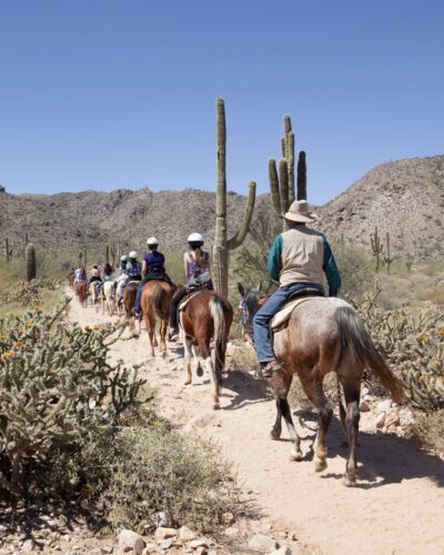
You’re driving along a flat stretch of desert land through some small towns surrounded by sandstone hillsides speckled with saguaros. Then, all of a sudden, red rock skyscrapers emerge from behind a bend, unlike anything you’ve ever seen before. You’ve just entered red rock country territory.
As you drive through the mountainscape to the Sedona area, you might have a hard time deciding which one you’ll explore first. Which one will give you fantastic views? Which ones won’t take that long to conquer?
Well, you can’t go wrong with any of Sedona’s hiking trails. However, if you’re looking for some guidance to make your trip and hiking experience unforgettable, you might want to take a look at the best Sedona hiking trails below for the ultimate day hikes.
9 Best Sedona Hikes
Whether you’re a novice hiker or an expert adventurer, we’ve gathered the best of the best hikes in Sedona below for varying skill levels, including the Devil’s Bridge, Bear Mountain, West Fork, Cathedral Rock trails, and a couple of other Sedona Hikes. Don’t forget all of the hiking essentials and accessories you may need to make your day successful.
Devil’s Bridge Trail
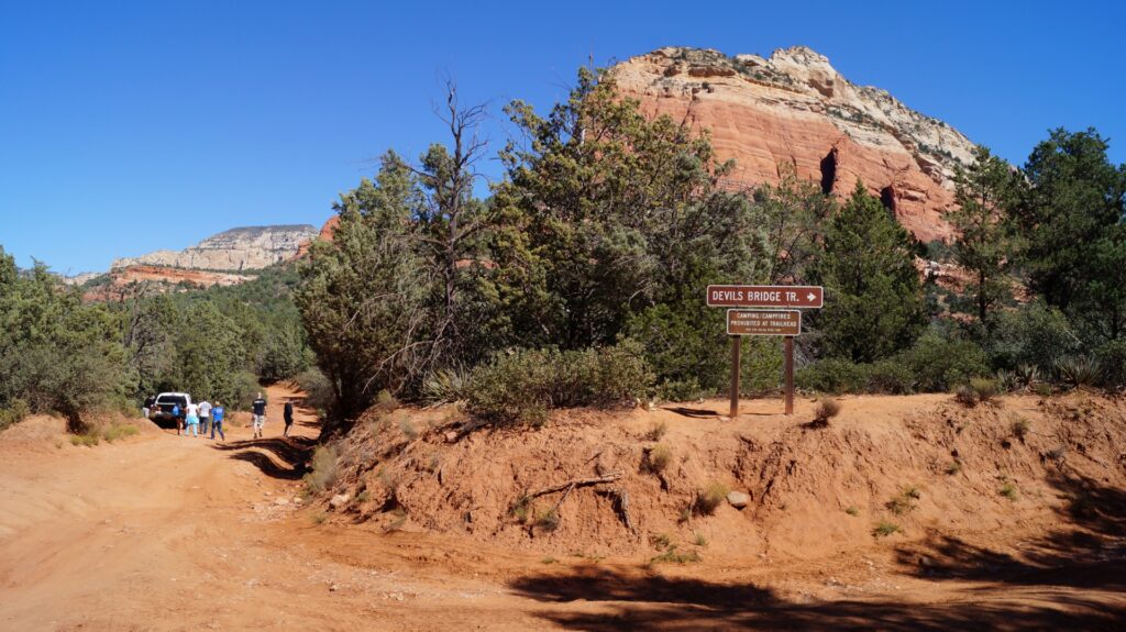
Despite the name, the Devil’s Bridge Trail is not as treacherous as you might think. Instead, you wind your way through some relatively flat land and wooded areas with great views of the surrounding red rock landscape.
After roughly three-quarters of the way toward the bridge, you’ll come across some gradual elevation gain that takes you up 400-feet along a mountainside. The incline gets steeper the further you climb, but beginners are still doable as long as they pace themselves.
Eventually, the trail will spit you out into an amphitheater-like area carved into the rocks that overlook the famous sandstone arch. You can continue further to walk across the bridge and snap a photo or two for the daring.
The trail, in its entirety, is nearly four miles round trip. It’s also trendy, so you can expect heavy foot traffic and sometimes difficult parking for the trailhead. Speaking of which, you can access the Devil’s Bridge Trail via Dry Creek Road.
You’ll see a sign for the trailhead parking, but the actual trail begins a little ways further down the road, which is why you’ll notice many cars parked along the street rather than in the parking lot itself.
Length: 3.9mi
Elevation Gain: 521ft
Trail Type: Out and back
Difficulty: Easy
How to get there: 1.3mi down Dry Creek Rd, parking lot on your right
Safety tips: Bring plenty of water and watch your step as you hike.
Bear Mountain Trail
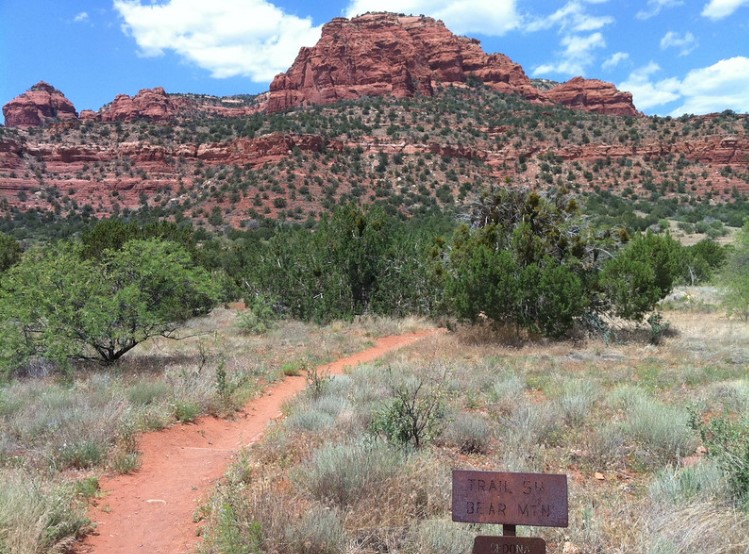
Are you looking for a great yet challenging hike? Then, the Bear Mountain Trail might be the one for you. You might consider this hike either moderate or complex, depending on your fitness level. Still, the 1,800-foot elevation can affect even the fittest of people due to the atmosphere change.
The little over two-mile hike takes you to the top of Bear Mountain and features stunning views with each step. It has steady, flat terrain, rocky switchbacks, and overlooks the Fay Canyon trail at specific stops. You can even see the San Francisco Peaks from the Red Canyon peak point.
In total, the Bear Mountain trail is almost six miles long. Make sure you bring plenty of water and stop as needed along the way. Do not veer off the course for side excursions to protect the wilderness and for your safety, as the trail can become treacherous if not followed correctly.
Length: 4.6mi
Elevation Gain: 2,100ft
Trail Type: Out and back
Difficulty: Difficult
How to get there: Turn left onto FR 152C from Boynton Pass Rd. Continue for about a mile, and the parking lot is on your left.
Safety tips: Watch and stick to the white, diamond-shaped trail markers and bring plenty of water
Cathedral Rock Trail
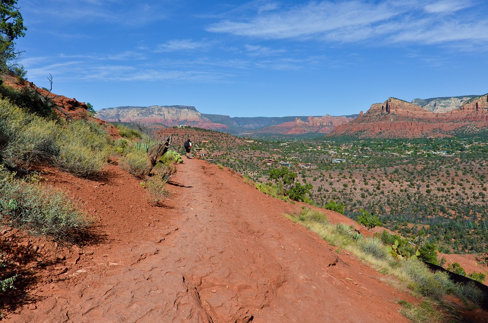
The Cathedral Rock trail is not for the faint of heart if you plan on reaching the top. It features steep inclines and rounded surfaces to climb that require a certain level of athletic prowess although, you don’t have to be an expert hiker.
However, if you don’t care to reach the rock formation’s peak, you can always take the easy hike route up to the flattened base area below for great views and an impromptu photoshoot. If you are confident in your climbing abilities and want to reach the top, you’ll find incredible panoramic views from 741-feet up at the end of the trail.
Altogether, the Cathedral Rock Trail is only a mile and a half there and back but is more like traveling up and back. You’ll find the trailhead connected to the parking area just off of Back O Beyond road. Don’t forget to bring some sunscreen with you for this hike as it is not shaded.
Length: 1.5mi
Elevation Gain: 741ft
Trail Type: Out and back
Difficulty: Moderate
How to get there: .6mi down Back O Beyond Rd on your right.
Safety tips: Be careful with your footing as the trail quickly ascends in sections and features rounded rock edges.
Courthouse Butte Loop Trail
You can enter the Courthouse Butte Loop Trail from either the Bell Rock Pathway and Vista trail or the Courthouse Vista trail. Whichever way you choose, you will head toward Bell Rock until the trail splits and you see the trail marker for the Courthouse Butter Loop Trail.
The trail fully encircles the Courthouse Butte, giving you the best views of both the Butte and Bell Rock. It does not feature the drastic elevation you might expect with some of the other popular trails, but the Coconino Forest Service still considers it a moderate hike because of its two-and-a-half-hour trip time.
You’ll find both trail entrances along route 179 at trail postings 307 and 308, just a mile or so apart. Make sure you bring plenty of water for this hike since you will be walking along the rail for quite some time.
Length: 3.9mi
Elevation Gain: 351ft
Trail Type: Loop
Difficulty: Moderate
How to get there: Take 179 South toward either Bell Rock or Courthouse Vista trailheads
Safety tips: Expect this hike to take a couple of hours, so bring plenty of water.
Templeton Trail
If you’ve finished scaling Cathedral Rock and want to cool off, you can veer off the Templeton Trail near the Cathedral Rock trail’s beginning. The route takes you around the rock formation and descends along the side in a rocky path.
The descent spits you out onto sandy ground that cuts through the remote mountain wilderness until you eventually stumble upon Oak Creek. Even if you don’t want to hike Cathedral Rock, you can park and access the trail from the Cathedral Rock trail entrance along Back O Beyond road.
You can also access it from the Baldwin Trail, the Bell Rock Pathway, or the Little Horse Trail.
Cathedral Rock might be the most straightforward access point.
From there, it’s a three and a half mile hike down and the same returning. The trail gets relatively narrow at points during the decline, and it is considered a moderate hike because of its length.
Length: 3.5mi
Elevation Gain: 708ft
Trail Type: Out and back
Difficulty: Moderate
How to get there: It’s accessible via the Templeton trail located at Cathedral Rock off of the Back O Beyond Rd or the Baldwin Trail, four miles from route 179.
Safety Tips: Watch your footing as the trail descends quickly in parts and covers rocky terrain.
Doe Mountain Trail
The Doe Mountain Trail is a popular hike among tourists visiting Sedona, Arizona; however, it doesn’t typically have as much foot traffic as others, such as Devil’s Bridge and Cathedral Rock. The hike is roughly one and a half miles round trip up the mountainside and levels out on top at the mesa.
Even though the trail features a steep climb at points, the hike is pretty straightforward and well worth the ascent when you reach the top. You get beautiful views of Wilson Mountain, Bear Mountain, Munds Mountain, and pretty much the entirety of Verde Valley from the mesa.
You can get to the Doe Mountain parking area and trailhead via FR 152C at the Boynton Canyon trail intersection off Dry Creek road.
Length: 1.5mi
Elevation Gain: 708ft
Trail Type: loop
Difficulty: Moderate
How to get there: Take FR 152C at the Boynton Canyon trail intersection off Dry Creek road.
Safety Tips: Stick to the marked trail and bring water due to the lack of shade coverage.
West Fork Trail
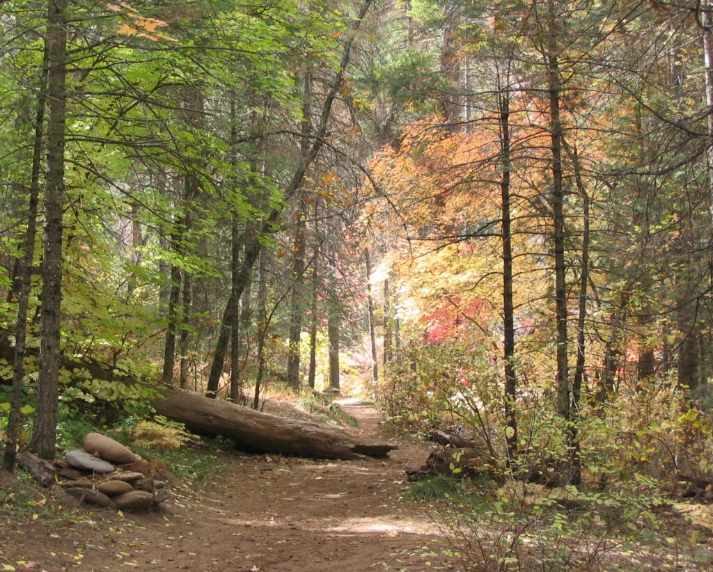
The West Fork Trail is a popular route tourists use to get to Oak Creek Canyon.
You should know beforehand that if you attempt the whole 14-mile hike, you will need to wade through water for part of the way, which can prove challenging. If you stick to the initial three-mile hike, you will have to cross over the creek a time or two, so watch your footing as you go.
The trailhead for West Fork is a bit hidden behind a few creekside houses at the Call O the Canyon park area just north of Sedona city.
Length: 14mi
Elevation Gain: 567ft
Trail Type: Out and back
Difficulty: Moderate to difficult
How to get there: The trailhead is located just north of Sedona city at the Call O the Canyon park area.
Safety Tips: Take your time during this hike, and do not push yourself to the entire trail extent if you are not an experienced hiker.
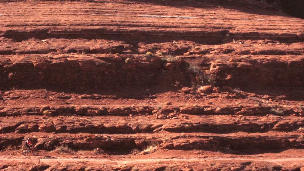
Broken Arrow Trail
Whether you’re looking for an easy hike or a place for mountain biking, the Broken Arrow Trail is the path to take for both. It’s about a three-and-a-half-mile walk, passing by the Devil’s Dining Room and Submarine Rock. Finally, the trail leads you up to a plateau encompassed by towering Red Rocks.
You can access the trailhead via Morgan road off of route 179. Since the trail is popular for biking, it would be best to stay on the lookout for mountain bikers as you hike. Pink Jeep tours also frequent the route, so be on the lookout for some of those famous jeeps climbing near you.
Length: 3.5mi
Elevation Gain: 400ft
Trail Type: Out and back
Difficulty: Moderate
How to get there: The trailhead is located off of route 179 on Morgan road.
Safety Tips: Watch out for heavy traffic by people, mountain bikes, and jeep tours.
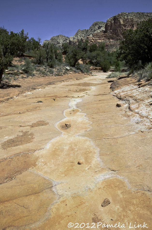
Soldier Pass Trail
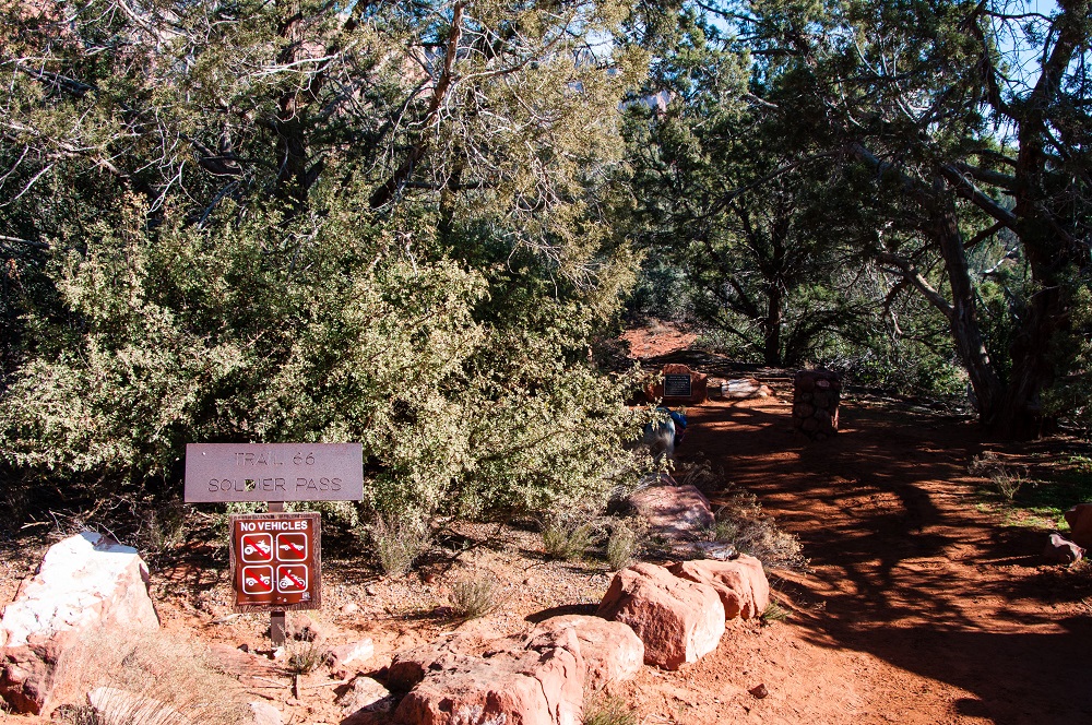
Climb the Solider Pass Trail to reach the breathtaking Soldier Pass cave, which is unlike anything you might’ve seen before. It’s like a lengthy tunnel carved directly into the Red Rock. It also diverges with the Devil’s Kitchen Sinkhole, which you can explore during your hike.
Or, you can divert from the path toward the Seven Sacred Pools for a bit of meditation and a quick photo or two before continuing toward Brins Mesa for full vista views of the red rocks around you.
The trail isn’t too tricky, but with some incline and various potential stops, you might consider it a moderate hike. Altogether, the hike is about a two-and-a-half-hour journey. You can find its trailhead behind a gated entry road off of Rim Shadows drive.
Length: 4.5mi
Elevation Gain: 839ft
Trail Type: Loop
Difficulty: Moderate
How to get there: Take Soldier’s Pass Rd to Rim Shadows Dr to find the trailhead on your left.
Safety Tips: Watch your step as the trail becomes increasingly steep and bring plenty of water for the journey.
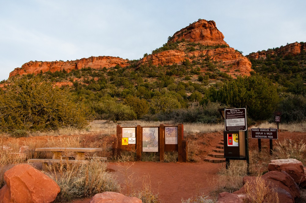
Book Your Sedona Visit
Everyone should visit Sedona at least once during their lifetime. And, with a hearty list of all the best hikes in the area, the only thing left for you to do is book a stay at a local vacation rental property and head on over for a gorgeous, unforgettable trip.
Featured Image Credit: By Nikolas_jkd