

 Author:

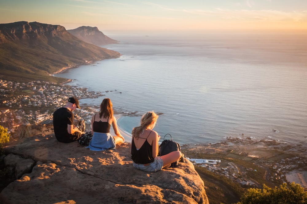
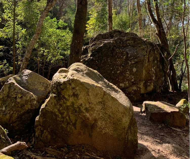
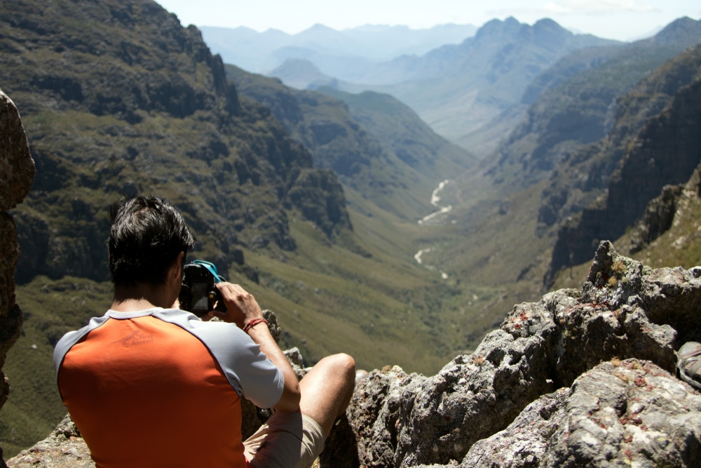
Cape Town is one of South Africa’s most beautiful regions thanks to its rugged, mountainous landscape and white sandy beaches. For adventurous travelers, it’s the perfect destination for hiking and climbing.
The likes of Table Mountain, Lion’s Head, and Chapman’s Peak offer the best hiking trails in South Africa and some of the most incredible views in the world.
There’s no shortage of trails in Cape Town for hikers of all experience levels. Whether you’re a seasoned climber looking for a challenge or a newbie who wants a peaceful stroll, you’re bound to find plenty of routes to suit you.
Here are some of the best hikes in Cape Town to get you started.
Lion’s Head Summit
- Hiking Distance – 2.7 miles
- Elevation Gain – 369 meters
- Route Type – Out and back
- Difficulty – Hard
- Duration – 2.5 hours
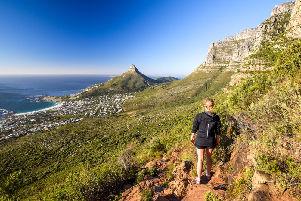
The Lion’s Head Summit hike is one of the best ways to enjoy panoramic views of the Western Cape, Table Mountain, Table Bay, the Twelve Apostles, Robben Island, and the Atlantic Ocean.
The trail starts at the parking lot on Signal Hill Road, so it’s easy to access from Cape Town city center. Since it’s such a popular route, you can tackle it confidently, knowing there are plenty of other people around.
The hiking route is incredibly well-marked, but it’s challenging in several places. Some parts feature ladders and staples to assist with steep inclines. One section is suitable for climbing with staples and chains if you’re up for a challenge, but it can be bypassed if you don’t feel confident enough.
Pets are welcome on the trail, but sections of it are very steep and challenging for four-legged friends, so most people leave them at home.
It usually isn’t advisable to hike in Cape Town after dark, but Lion’s Head is a popular route when there’s a full moon to help light the way. Hikers head out with headlamps in the early morning hours to reach the summit by sunrise and enjoy spectacular views as the day breaks.
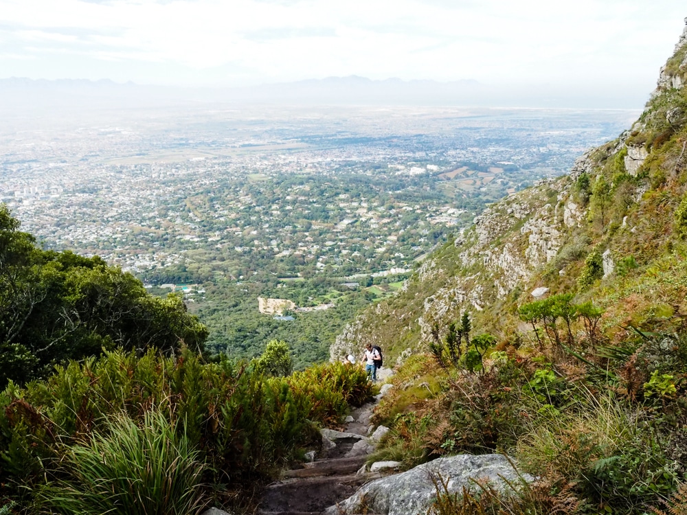
Platteklip Gorge
- Hiking Distance – 2.5 miles
- Elevation Gain – 650 meters
- Route Type – Out and back
- Difficulty – Hard
- Duration – 3 hours
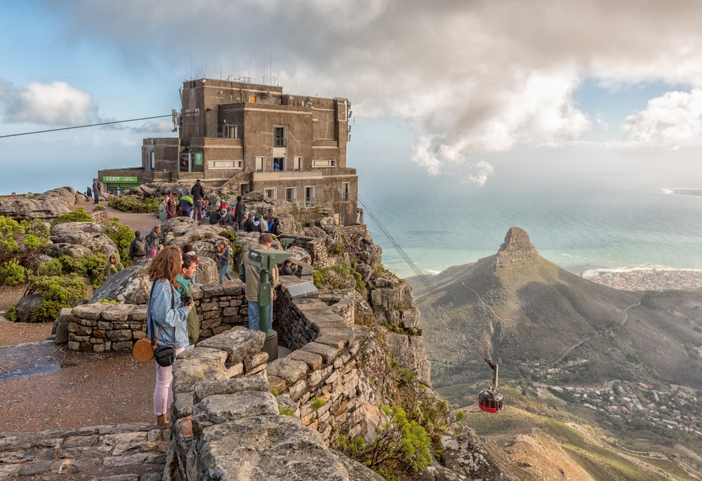
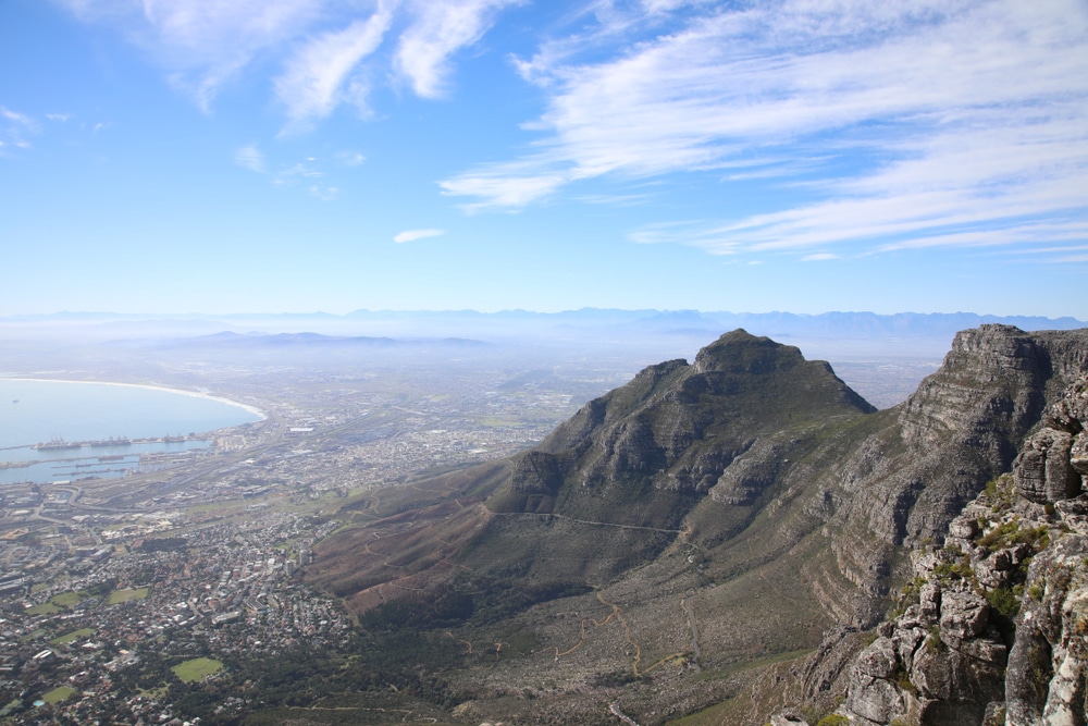
Platteklip Gorge sits on the front face of Table Mountain and is a popular route to the summit because it’s direct and easy to follow. This doesn’t necessarily mean it’s easy to complete. The entire trail is a steep climb. There isn’t much scrambling involved, but portions of tall and rocky stairs give the legs a good workout.
The Platteklip route begins at Tafelberg Road, just past the lower cable car station, where you can park for free. It ends at the top of the mountain, around 700 meters from the upper cable car station, so if you’re not up to the descent, you can take the cable car instead.
Despite its relatively short length, it’s important not to underestimate the challenges of the Platteklip Gorge route. It’s very exposed, and sometimes the weather changes quickly, with strong winds and cloud cover posing serious risks to less experienced hikers.
The route also becomes incredibly hot during the day. It’s best to tackle it in the morning or evening, but be sure to make it back down before it gets dark or before the last cable car leaves.
Pro Tip: South African National Parks (SANParks) undertake many rescues at Platteklip Gorge due to extreme weather, inadequate levels of fitness, and hikers becoming stranded at the top of Table Mountain due to missing the last cable car.
Check the weather forecast and cable car opening times and plan your hike accordingly.
Cecilia Waterfall via Cecilia Forest
- Hiking Distance – 2.7 miles
- Elevation Gain – 324 meters
- Route Type – Loop
- Difficulty – Moderate
- Duration – 2 hours
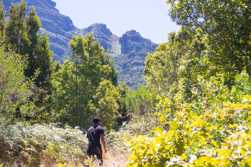
Cecilia Waterfall sits within Table Mountain National Park, and the forest trail that leads to it makes for a beautiful and relatively easy hike. Start at the Cecilia Forest parking lot, which you can use for free. The route can be taken via the jeep track or a footpath, with the latter being a little steeper and a little shorter.
The first half of this hike is in the forest, where the shade of the trees keeps you cool. The second half is fairly exposed, so ensure sun protection and plenty of water. You can refill bottles from the waterfall itself, which is a picturesque sight and the perfect place to rest for a while before continuing along the loop trail to return to the entrance.
At just 2 hours long, this trail is easy to combine into a day trip to the Constantia Valley, which is just 3 miles away. There’s a range of wine farms in the Constantia Region where you can enjoy wine tasting and vineyard tours.
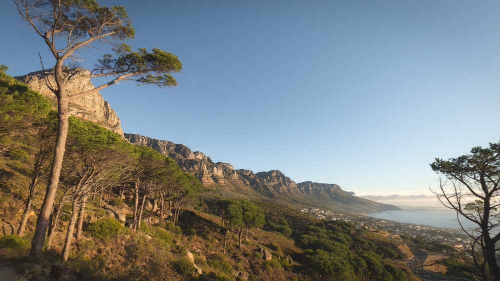
The Pipe Track from Kloof Nek
- Hiking Distance – 5.9 miles
- Elevation Gain – 340 meters
- Route Type – Out and back
- Difficulty – Moderate
- Duration – 3 hours
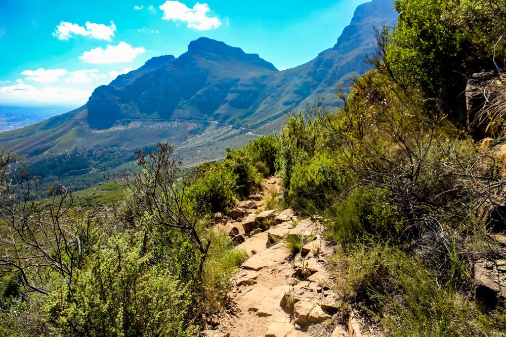
The Pipe Track is one of the oldest Table Mountain National Park hike trails, dating all the way back to 1887. It is named after the huge pipeline that was constructed to carry water to Cape Town from Table Mountain. It offers fantastic views over Camps Bay and the Twelve Apostles.
This track starts at a parking lot at the junction of Tafelberg and Kloof Nek roads and follows the contours of the western side of Table Mountain all the way to Corridor Ravine.
It is relatively flat and easygoing for most of the route, but it gets more challenging after passing Slangolie Ravine. Since it’s an out-and-back route, you can turn around at any point.
It gets hot on the Pipe Track in the middle of the day, so it’s best to head out in the mornings and evenings. Make sure you get back to your car before the sun goes down. Several trails lead off the Pipe Track but do not attempt these without a guide as they can be challenging, and it’s easy to get lost without an experienced local with you.
Skeleton Gorge
- Hiking Distance – 3.1 miles
- Elevation Gain – 900 meters
- Route Type – Out and back
- Difficulty – Moderate
- Duration – 3 hours
Skeleton Gorge is a brilliant way to scale Table Mountain via a cool, shaded route since most of the trail is blanketed in trees. It begins at Kirstenbosch Botanical Gardens, where parking is available for free.
A rocky track winds its way through the forest, passing a stream and winding between mountain fynbos (a small belt of shrub-like vegetation) that is exclusive to South Africa and various unique rock formations.
The top of the route is close to the Hely-Hutchinson Reservoir, which has a pretty beach to relax on before heading back. Alternatively, you can check out Maclear’s Beacon, which is the highest point on Table Mountain. This is a fantastic spot to enjoy panoramic views of the Atlantic, Robben Island, and the Mother City itself.
The Skeleton Gorge hike is a moderately difficult route. The entire trail is steep, and some sections have ladders to assist you. There’s also some rockfall to clamber over, so hikers need to be in good shape.
Since much of the route is under the cover of the forest, it can get slippery underfoot even in the height of summer. Avoid hiking it after heavy rainfall, and check the weather forecast to avoid facing strong gales and thick clouds once you reach the top of the mountain.
India Venster to Upper Cable Station
- Hiking Distance – 1.8 miles
- Elevation Gain – 700 meters
- Route Type – Point to point
- Difficulty – Very hard
- Duration – 2 hours
Experienced hikers love the challenge of the India Venster route, which begins near the lower cable car station at the foot of Table Mountain. There are long sections of ladders and chains, with portions of rock to scramble over.
There’s no shade at all, which makes the route hot and draining, but your efforts are rewarded with stunning views of Table Mountain, Camps Bay, City Bowl, and Chapman’s Peak.
Although it is possible to take this trail both up and down, its steep nature makes the descent tricky. Most hikers find it more enjoyable to take the cable car down or walk back via a longer, more leisurely route.
You should start this route early in the morning to avoid getting overwhelmed by the heat since there’s no shade at all. Avoid this hike if there are strong winds, and be prepared for chilly temperatures at the top.
Kasteelspoort Trail to Diving Board
- Hiking Distance – 2.9 miles
- Elevation Gain – 576 meters
- Route Type – Out and back
- Difficulty – Moderate
- Duration – 3 hours
The Kasteelspoort Trail takes you up the 12 Apostles, which are the huge peaks that make up the western slopes of Table Mountain National Park. Along the way, you can enjoy incredible views of the Atlantic Ocean, Camps Bay, and Hout Bay.
If you’re feeling brave, you can step out onto the ‘diving board’ once you reach the summit. This is a flat granite rock that hangs over the mountainside. It offers amazing views and an excellent photo opportunity, but the dizzying height is not for the fainthearted.
This trail is steep but with only a few small scrambles over rocks, and it tends to be less busy than other routes up Table Mountain. Look out for the remains of the old cableway en route. This system was used to transport supplies to the top of the mountain range during the construction of dams in the 1800s.
The Kasteelspoort Trail starts from the Pipe Track. For a shorter route, you can access it from the jeep track, which starts at the parking lot on Theresa Road and intersects the Pipe Track. Check the weather forecast before you go and avoid the ‘diving board’ on windy days, as strong gusts can make it very dangerous.
Devil’s Peak via Saddle Rock
- Hiking Distance – 3.5 miles
- Elevation Gain – 599 meters
- Route Type – Out and back
- Difficulty – Moderate
- Duration – 3 hours
Devil’s Peak flanks the eastern edge of Table Mountain and offers brilliant views of both Table Bay towards the west and False Bay towards the east. The route up via Saddle Rock offers fantastic views of the Atlantic Ocean.
Keep in mind that Devil’s Peak is the second-highest point in the Table Mountain National Park after Maclear’s Beacon. This means you’ll get fantastic views only after a steep climb. Winds can be strong as you reach the top, so take warm clothes and avoid the route when strong gales are forecast.
The hike begins at Tafelberg Road, where free parking is available. Aside from its steep nature, this route isn’t too challenging. Expect some loose rock on the path and light scrambling as you reach the summit.
Newlands Forest Short Circuit
- Hiking Distance – 2.1 miles
- Elevation Gain – 147 meters
- Route Type – Loop
- Difficulty – Moderate
- Duration – 1 hour 5 minutes
Newlands Forest is a great spot for a day trip because it’s packed with attractions, including City Parks Nursery, Newlands Reservoir, and Lady Anne Barnard Cottage. There are many different hiking trails through the forest, but the short circuit is ideal for amateur hikers who want a route they can incorporate into a full day at Newlands Forest.
The forest sits within the Cape Floral Region of Table Mountain National Park. Cape Flora is one of the world’s richest floral regions, and 70% of its flowers are endemic to Table Mountain. This hike is perfect for nature enthusiasts who want to see Cape Town’s unique plant life.
The short circuit at Newlands Forest is moderately challenging. It isn’t too steep, but there are some sections of rocky path underfoot. Much of the route is in shade, which makes it comfortable in hot weather.
Cape of Good Hope Trail
- Hiking Distance – 2.9 miles
- Elevation Gain – 268 meters
- Route Type – Out and back
- Difficulty – Easy
- Duration – 1 hour 45 minutes
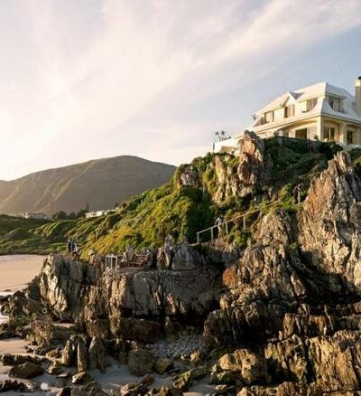
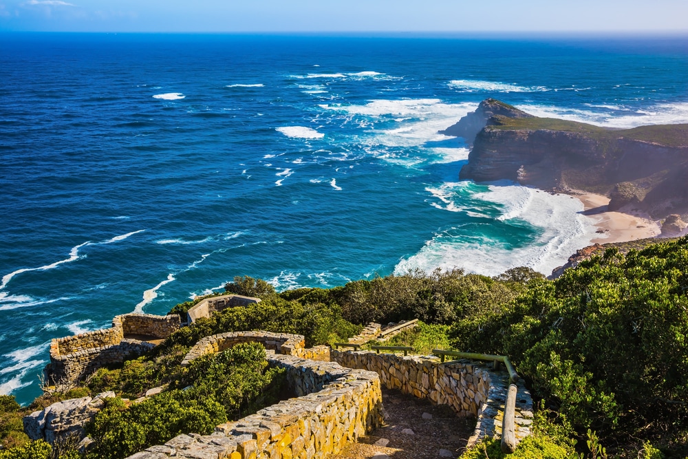
There’s no better way to see the spectacular rugged cliffs and rock formations of the Cape Peninsula than the Cape of Good Hope trail.
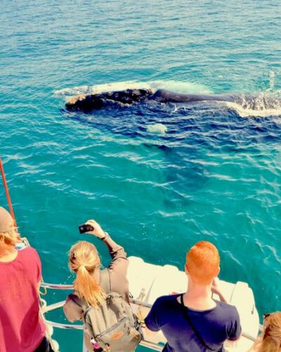
This route sits within Cape Point National Park, which is a nature reserve. You can see a huge variety of wildlife in the park, including antelope, mongooses, zebras, and ostriches. Dolphins, tortoises, and whales populate the ocean in this area too.
The Cape of Good Hope is a rocky headland on the southern coast of the Cape Peninsula. The trail to it is a very easy, flat hike and a very popular one. You get gorgeous views out to sea, but keep in mind that the area is susceptible to strong coastal winds and can get chilly. There’s no shade, so wear plenty of sunscreen as the cool wind makes it easy to forget the sun’s strength.
Most people plan a day trip to Cape Point National Park and visit both the Cape of Good Hope and Cape Point Lighthouse. The Flying Dutchman Funicular is a brilliant way to access the lighthouse and get incredible views of False Bay.
Jonkershoek Loop
- Hiking Distance – 6.2 miles
- Elevation Gain – 203 meters
- Route Type – Loop
- Difficulty – Moderate
- Duration – 2.5 hours
Jonkershoek Nature Reserve is situated near Stellenbosch, around 31 miles east of Cape Town. It’s a beautiful area dotted with waterfalls and scenic views. The Jonkershoek route starts at the parking lot at the entrance to the reserve. It’s an easy hike with a good road surface and gradual inclines.
The loop returns at the Witbrug (White Bridge), which is the perfect spot to take a break. You can drink from the river here and refill your water bottles. There are plenty more watering holes along the way, so you can take your time and soak in the beautiful scenery.
In summer, Jonkershoek gets incredibly hot, and it can be cold and wet in the winter, with snow possible. The weather here is very changeable, so check the forecast carefully and pack plenty of extra layers in case it gets cold and cloudy.
Cape Town Hiking Tips and Tricks
Safety
Hiking in Cape Town doesn’t come without risks, so keep these safety tips in mind when planning your trips.
- Strength in Numbers: Hike in groups of at least two but preferably four people
- Keep the Light: Hike during daylight hours only.
- Plan for Crowds: Complete less popular hiking routes on weekends or during public holidays when more people are around.
- Emergency Numbers: Take photos of signs at trailheads which usually list ranger numbers to call in the event of an emergency.
Packing List
Every hiking trail is different in terms of the supplies and equipment you’ll need to stay safe and comfortable, but here’s what you should pack for hikes in Cape Town.
- A backpack for carrying supplies.
- A large water bottle to last the entire hike since few trails have water sources on the way.
- Trail running shoes or hiking boots.
- A cap, sunscreen, and sunglasses since most trails are exposed with little shade.
- Walking poles, particularly on steep trails.
Adventure and Stay in Cape Town
Some of the best views of Cape Town can be found at vantage points on the hikes listed above. If you want to experience the beauty of the Western Cape at its finest, be sure to head out on some of these incredible trails.